Ochsenkopf
The tall tower is located on the summit, Ochsenkopf, in the Fichtelgebirge range in northern Bavaria, Germany. The Ochsenkopf site is the second highest point in the Fichtelgebirge range. The area surrounding the tower is covered with predominantly conifer forest out to a radius of about 100 km and lies in an agricultural region that has a relatively low population, about 10 people per km2 (from: Thompson et al. 2009)

Quick access:
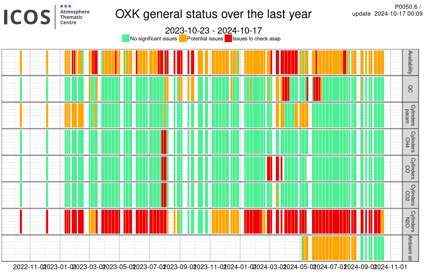
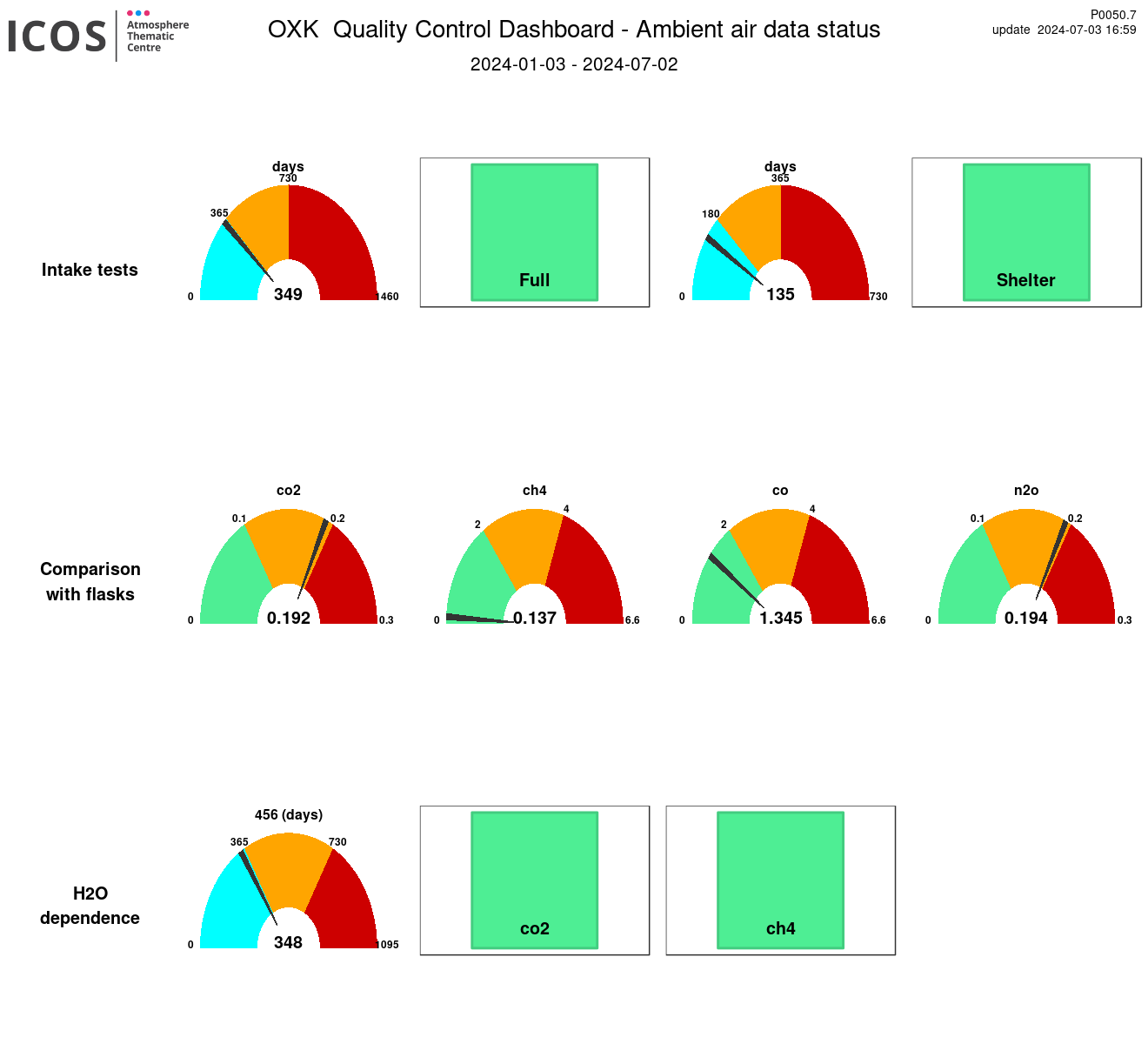
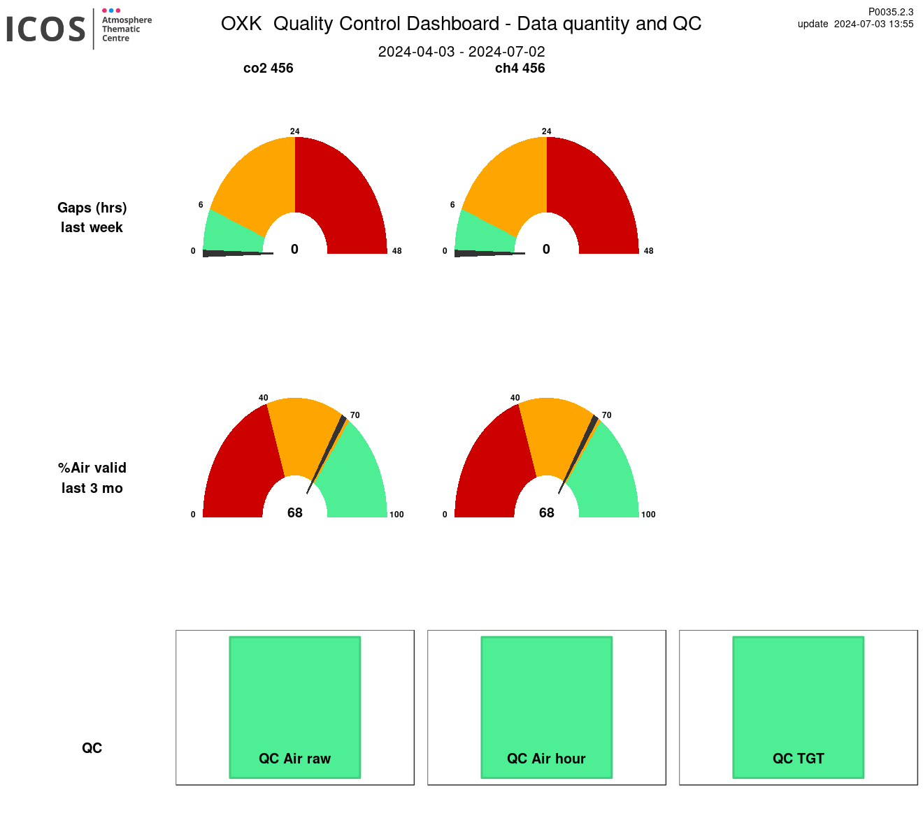
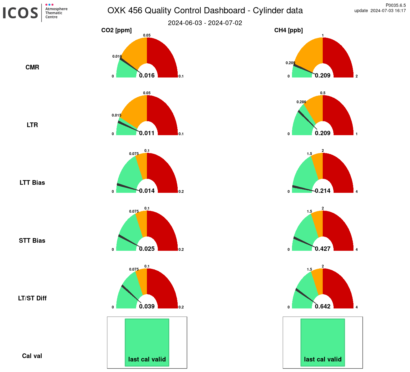
Instrument id: 456

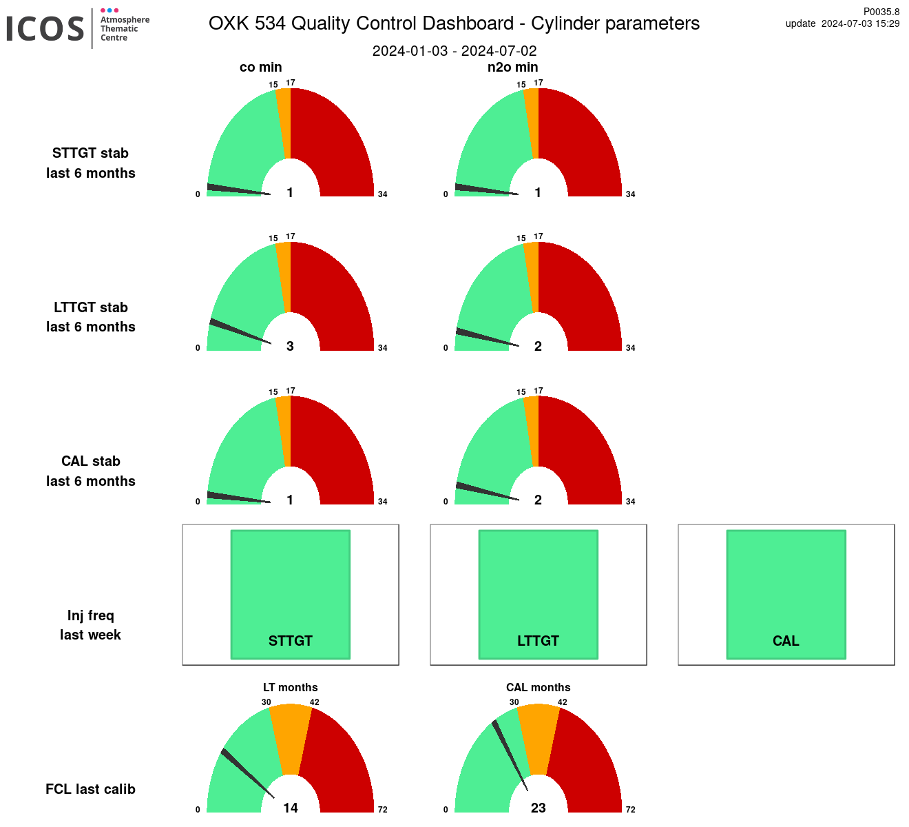
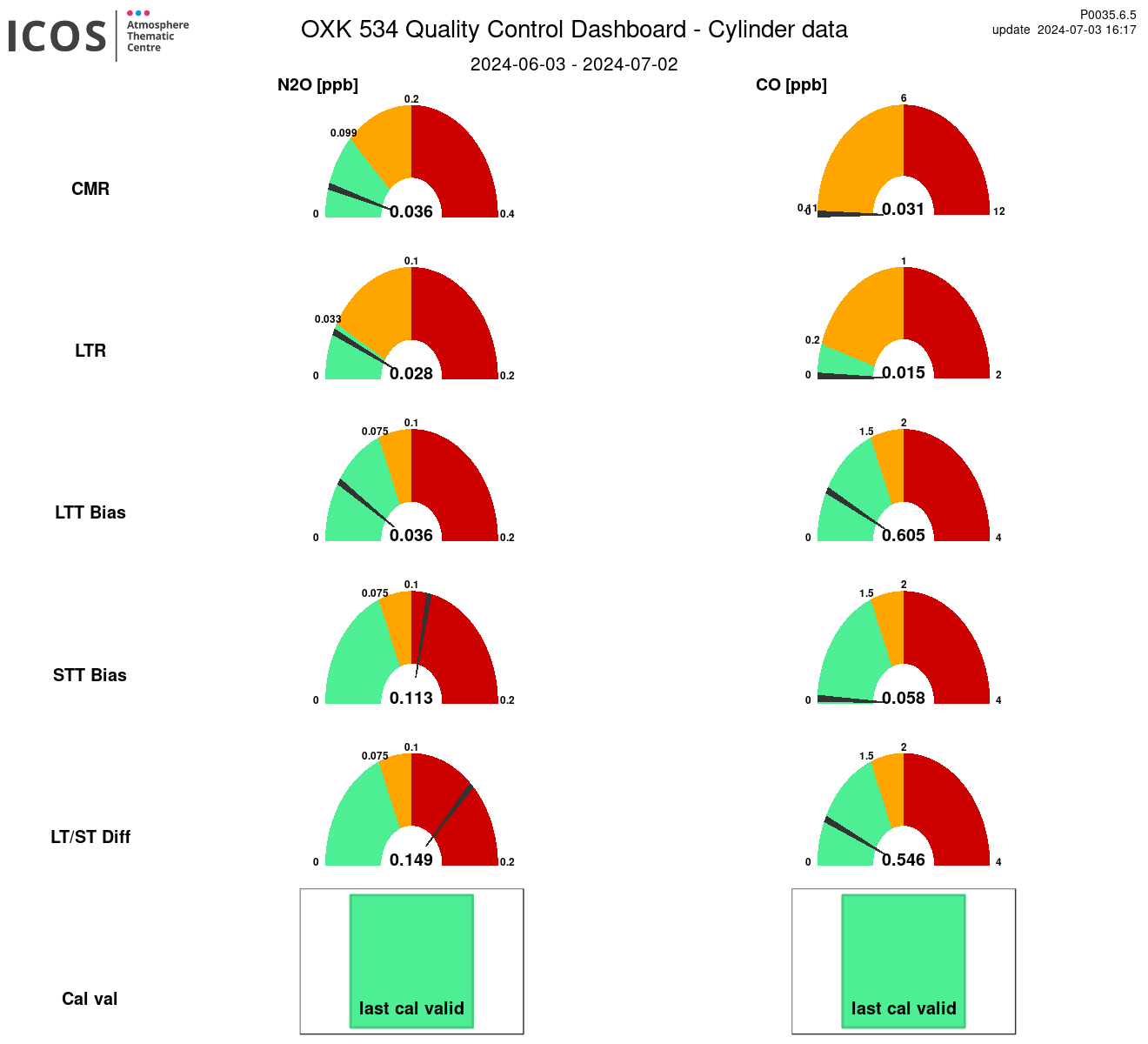
Instrument id: 534

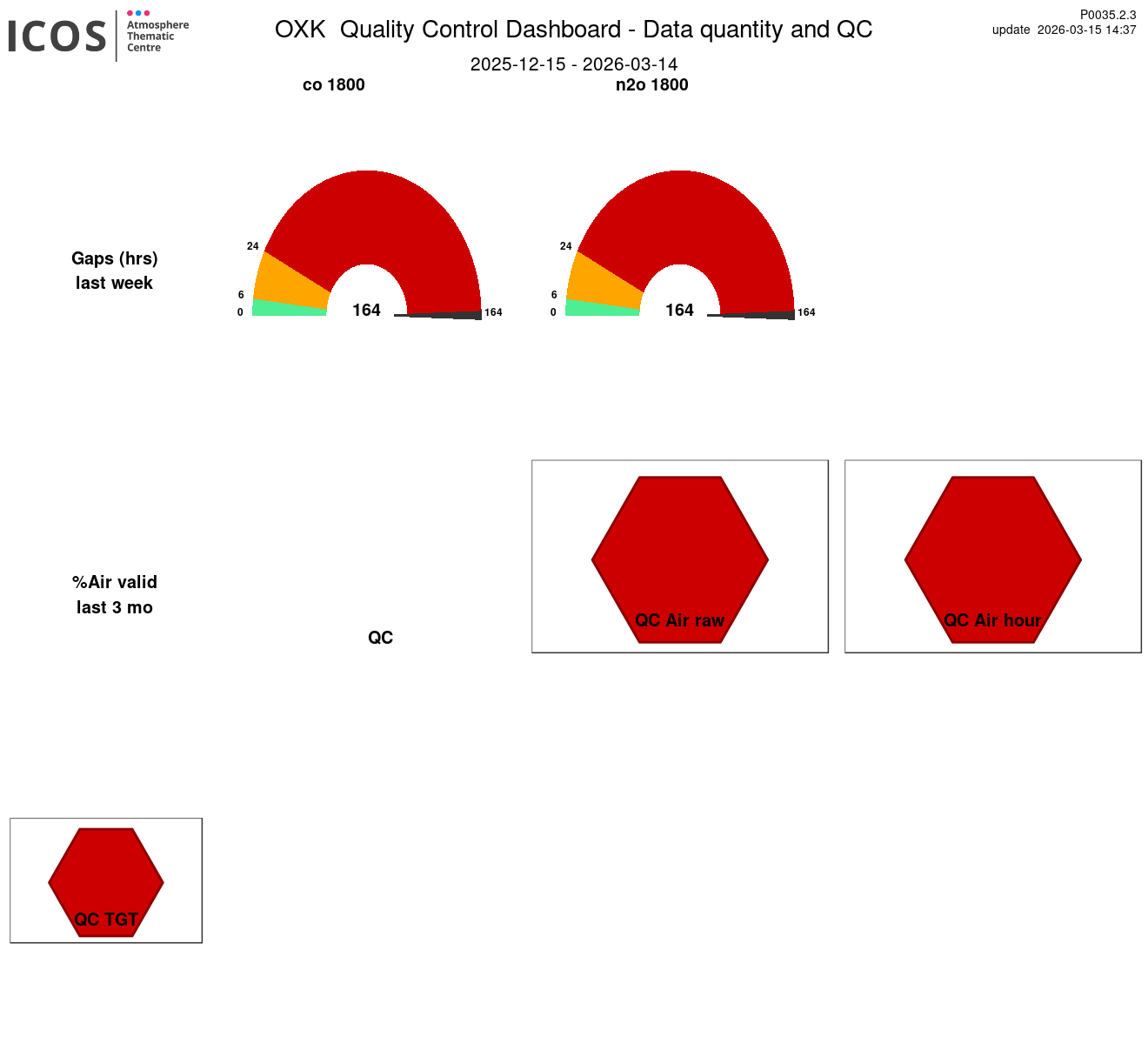
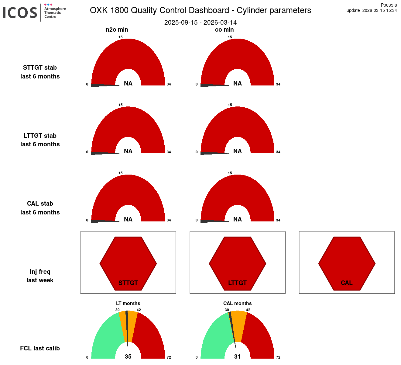
Instrument id: 1800

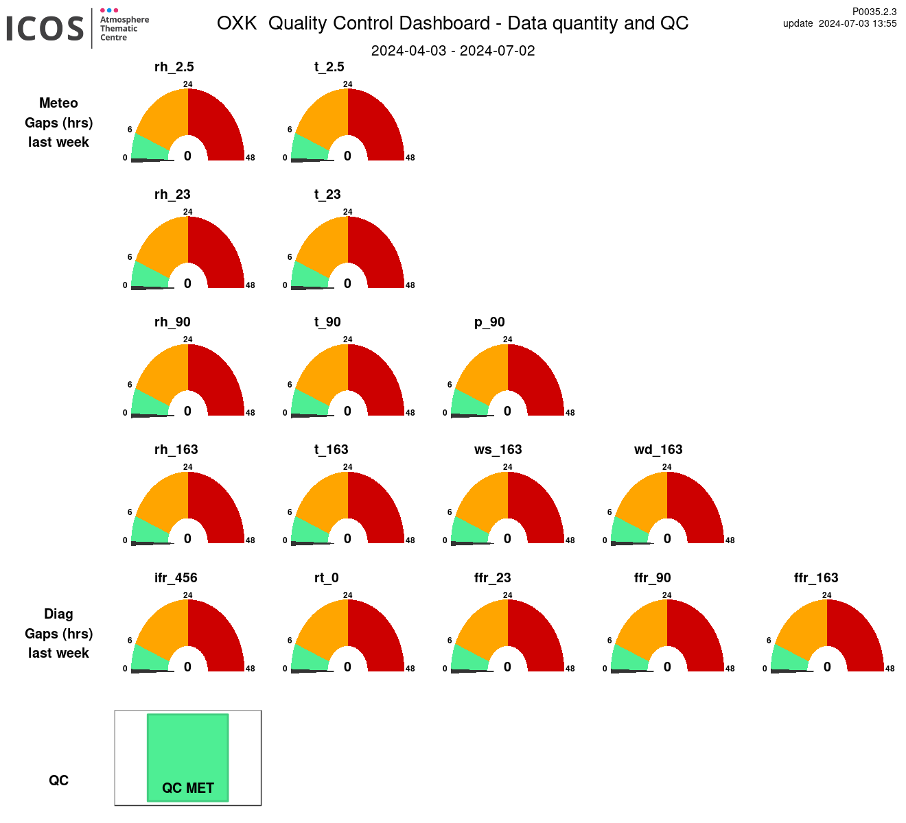
MET