Křešín u Pacova
Křešín u Pacova is located in the Czech-Moravian Highlands with an average altitude of 500-600 m ASL and rare spots of 700 m ASL. The highest hills Javořice (837 m ASL) and Devět skal (836 m ASL) are located 45 km and 65 km far from the site. The landscape of the Czech-Moravian Highlands is agricultural with occasional mixed forests. No higher orographic areas are located within a 100 km radius from the site. The station is located in a rural background area with no significant traffic and industrial emissions in its nearby surroundings. A highway is located 6 km to the north and east of the station, the wind frequency from these directions is 9 and 5%, respectively. Small (several hundreds of inhabitants) villages are at least 3 km far from the station, the closest towns (Pelhřimov, Vlašim and Humpolec, 10-17 000 inhabitants) are 20 km far. Small wood-processing industry is located 20 km to the west (prevailing wind direction). Havlíčkův Brod (20 000 inhabitants) is located 30 km from the site. Bigger towns (Jihlava, Tábor, 36-50 000 inhabitants) are about 40 km far. Farther, towns with populations of max. 35 000 inhabitants are located, except Prague (1 mil inhabitants, 80 km), Pardubice (90 000 inhabitants, 80 km) and České Budějovice (90 000 inhabitants, 90 km).

Quick access:
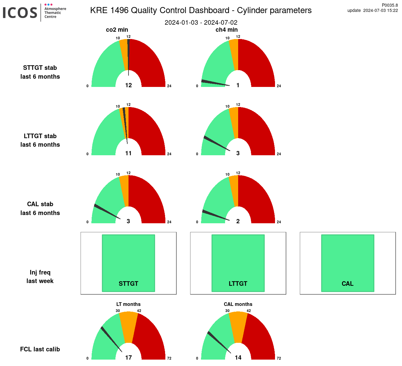
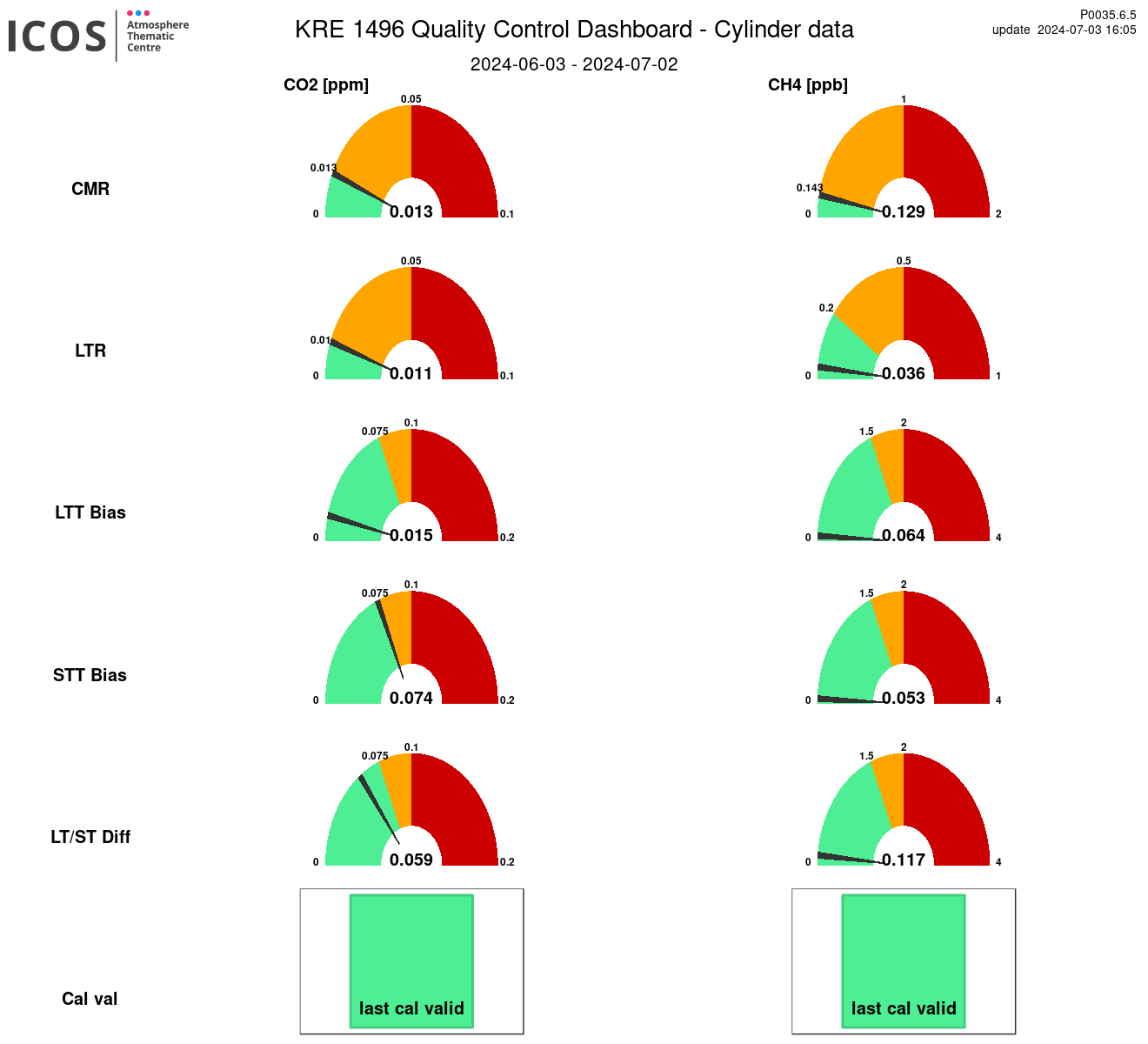
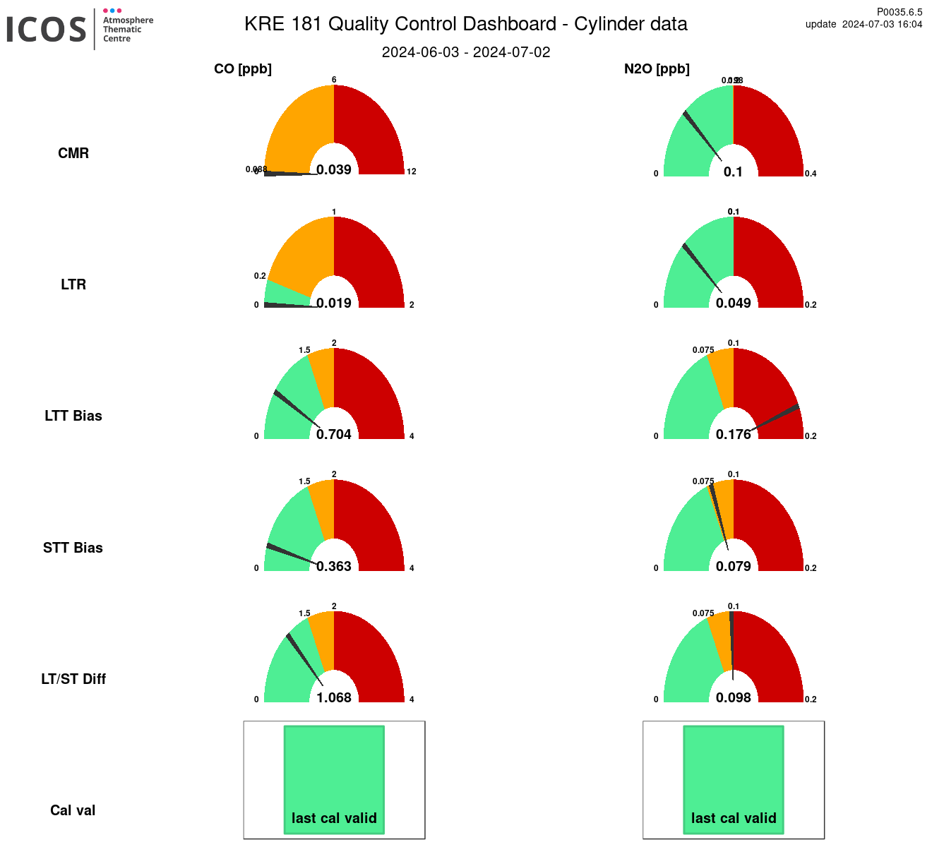
Instrument id: 1496

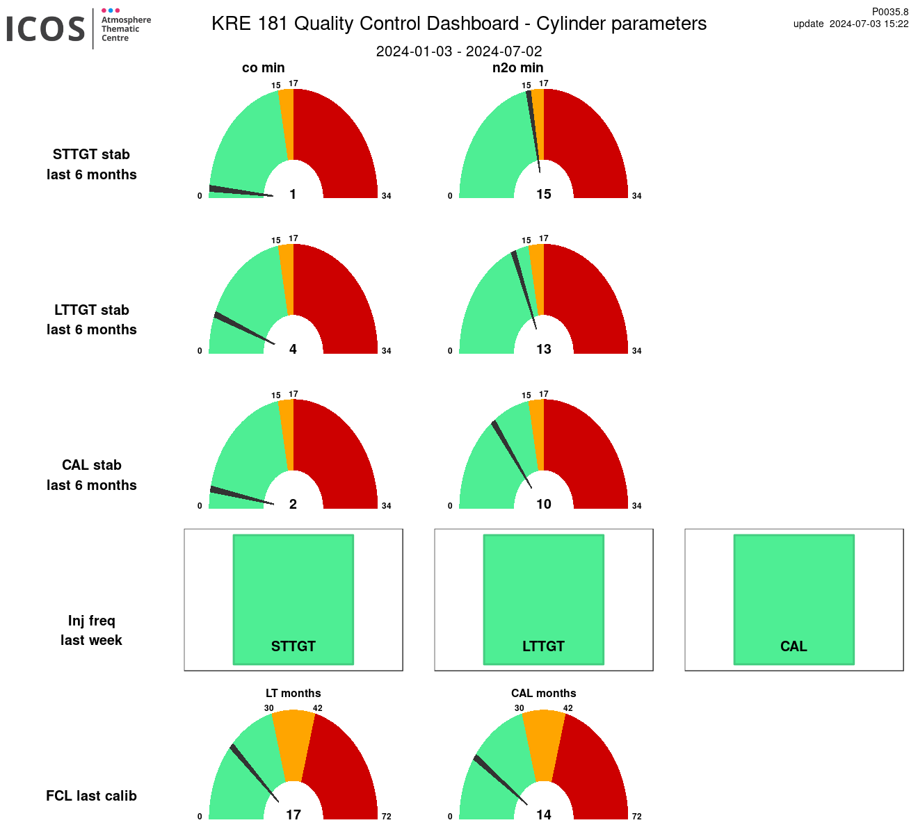
Instrument id: 181
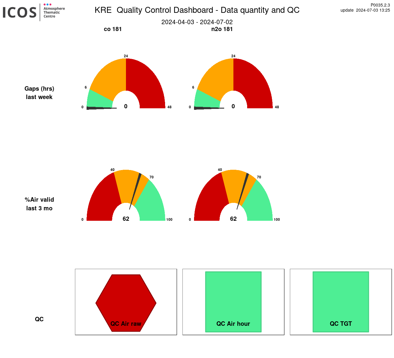
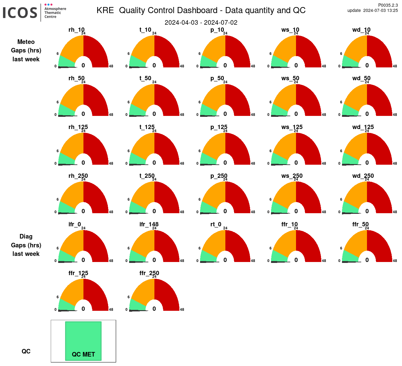
MET